DIHBU, in collaboration with DETEKTIA, a supported startup, is organizing this advanced training course to learn how to use satellite technology, key in infrastructure control.
The online course is supported by the European digital innovation centre DIGIS3, of which DIHBU is a part, which allows students from SMEs and public entities to participate in it free of charge, meeting the requirements.
If you are involved in any phase of the life cycle of a large infrastructure (planning, design, construction or operation) or work for entities related to civil engineering, it is important that you know about this satellite technology.
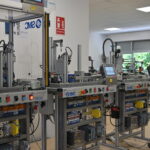
In the field of civil engineering, the challenge of controlling deformations in large infrastructures and even in entire cities is becoming more complex. Working with instrumentation and surveying campaigns alone is not sufficient to control all the deformation processes occurring in large areas. Experts in this field are demanding the integration of new technologies and data sources that will allow us to control our infrastructures more efficiently.
Satellite-based radar sensors generate a large amount of high quality and resolution data every day. InSAR (Synthetic Aperture Radar Interferometry) technology allows to measure with millimeter precision, from this enormous volume of information, the movements and deformations of the terrain and infrastructures. This technology, combined with on-site measurements, will change the way we observe, manage and operate our infrastructures.
What the course includes
- 3 months of specialized training
- Tutored by InSAR experts
- Training 100% up-to-date
- Access to advanced tools
Course cost and conditions
Students working for SMEs or public bodies based in Spain or an EU country have the option of taking the course free of charge.
Course dates
It is scheduled to start on February 20th 2025.